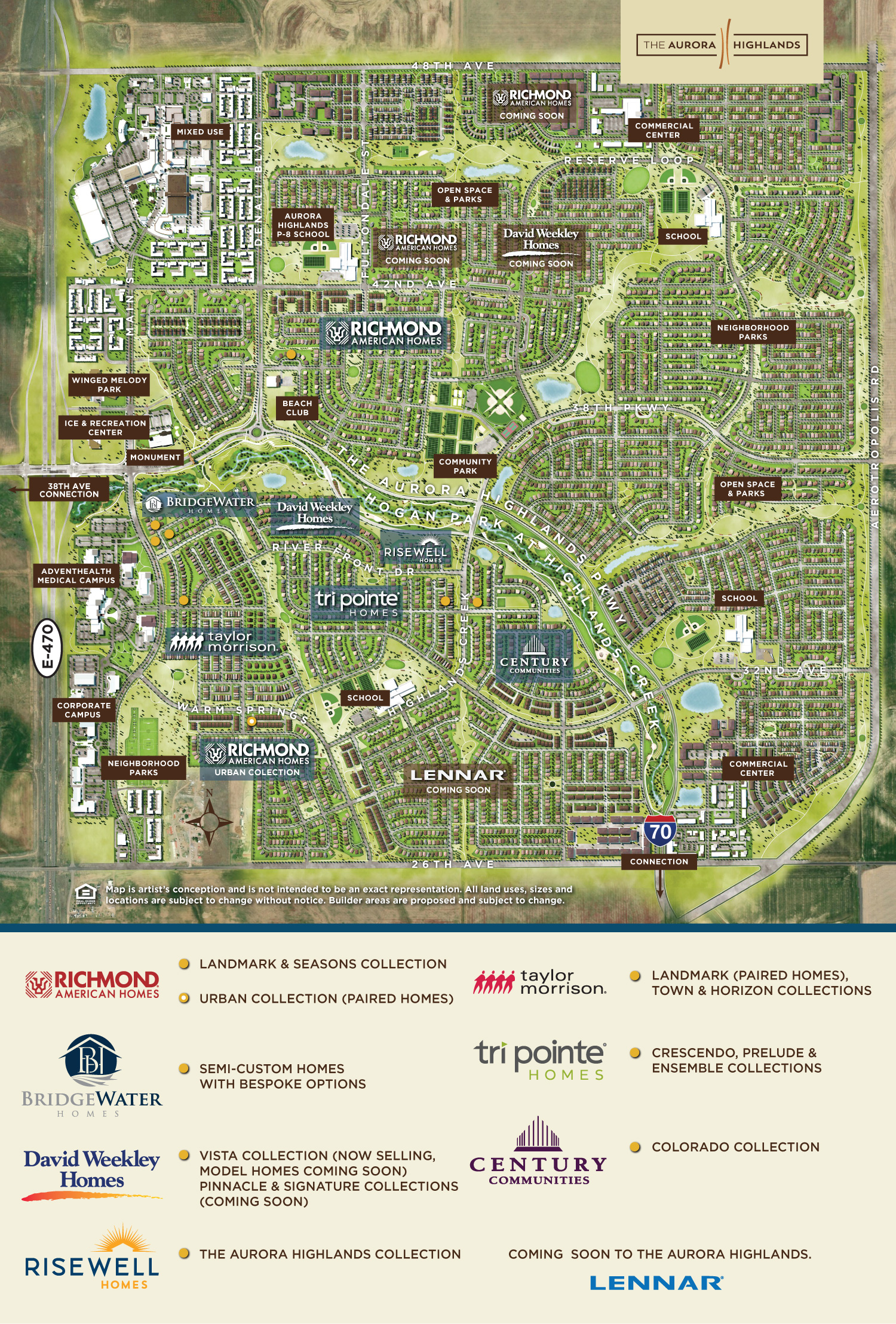
This is a map of The Aurora Highlands area, which seems pretty cool, but my complaint is that the road on the right side of the map which is labeled here as Aerotropolis Rd, already has a name, called Powhaton Road. Admittedly, it is not paved, but just leave the name as is. And the bottom right corner shows it going at an angle and then it meets up with The Aurora Highlands Parkway and then an arrow shows it connecting to I-70 off the map. Today, Powhaton Road connects to I-70, so there is no need for that angle. Or are they planning a new exit on I-70 about a quarter mile west of the Powhaton Road exit? If so, that doesn't make any sense.
Another oddity is the noticeable ley line next to Warm Springs Avenue. I wonder if it is a natural gas line that they don't want to build on.
One thing that is missing is that there is no grocery store anywhere close. The closest one is the King Soopers at Tower Road and Green Valley Ranch Boulevard, more than 5 miles a way. This would be a good location for a Sprouts or even a Walmart Neighborhood store.
More things that seem to be missing are a fire station and police substation. I don't even see a spot on the map where they would go. (I am thinking of SimCity where you have to plan the coverage). The closest fire station seems to be 6500 N Lisbon St, which is more than 5 miles away.
What about a high school, where is the closest one? There is a place for a high school in the northeast quadrant of the map, which is supposed to open in 2028.
But, overall, pretty cool for a master planned community, with lots of parks and trails.
No comments:
Post a Comment